Aerial imagery means taking photographs from an aircraft, drone, or airborne platform. Aerial imaging is the most fascinating technology for advancements in the agricultural sector. It helps farmers keep an eye on their fields 24 x 7, allowing them to take better care of the crops. Earlier, it was a challenge to monitor the farms and protect them from pests & other threats. Even now, most farmers have a limited view of their crops. This is especially true for farms with tall crops such as corn and fruit-bearing trees, where the view is severely limited.
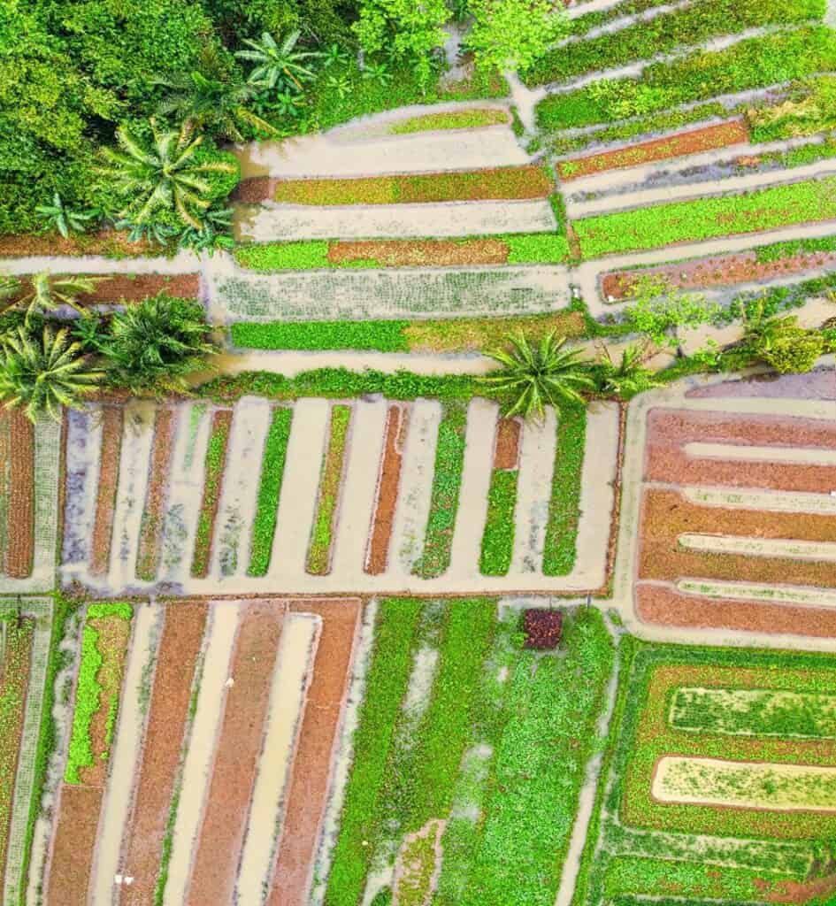
Aerial imaging is a process that involves taking images of a farm from the sky and ensuring the entire farm has been captured. When the sun is at its highest, a plane, which carries high-resolution advanced cameras, flies over the fields that are to be monitored. Multiple pictures are taken that show the condition of the fields. It is ideal to take aerial images at noontime since that is the time of the day when the crops are under the most stress and the lighting is optimal.Advanced aerial imaging also captures infrared images along with regular photographs. This provides visible insights on the overall condition of the crops and clearer images of the most hidden parts of the field. The information obtained from aerial imaging provides a comprehensive view of the fields to the farmers and helps them identify the problems that hamper the quality of the crops. For example, if one part of the farm is not getting as much water as the rest, it will show up as a patch of dried or wilted crops. Higher resolution images can also show signs of more serious problems such as pest damage or plant diseases.
Aerial imaging also helps in preparing the land for farming by checking the current status of the soil and making necessary advancements with the irrigation system if there is a requirement to do so.
The use of aerial imagery in agricultural production has continued to grow and evolve over the last several years since its launch in the market. With significant upgrades in how images are captured, processed, and their quality, there are now many applications for this technology in the agricultural sector. The three main options commonly used for aerial imagery in the agricultural industry are:
- UAVs or Unmanned Aerial Vehicles (or drones)
- Manned Aircraft (or small planes)
- Satellite-Delivered Imagery
Unmanned Aerial Vehicles (UAVs)
UAVs, commonly referred to as drones, are making waves in the agricultural industry by providing smart farming solutions. They use real-time data gathering and processing to improve farm-wide decision-making and efficiency, hence, freeing up time and money needed elsewhere within farm businesses. UAVs treat a few acres per day and assist manned aircraft by making imagery applications on small plots of land that are not suitable for traditional airplanes or helicopters.
Manned Aircraft (typically known as small planes)
Manned aircraft means any aircraft that is carrying or being operated by more than one person. Manned aircraft also provides high-quality, valuable imagery without the time commitment or overhead cost of using a UAV. Aerial application by manned aircraft is by far the fastest application method. Every year, aerial application pilots treat approximately 127 million acres of cropland in the U.S. This equates to 28% of all commercial cropland in the country.
Satellite-Delivered Imagery
Satellite data collects detailed information to predict crop yields. Earth observation (EO) data can measure details, such as soil moisture, to help farmers support crop health. Satellite imagery has been around for decades but continues to make improvements to the quality and timing of imagery available. Satellite technology is found to be dependable in crop monitoring since it accommodates regular revisit rates that produce consistent and accurate data. It also provides wider coverage than UAVs and Manned Aircrafts. This becomes especially useful when the farmers are carrying out time series analyses and other investigations or analyses. Further, satellite monitoring technology has been made more attractive by developing high-resolution sensors and constellations that allow for faster revisit rates.
Provided below is an overview of some common advantages and disadvantages of the types of aerial imagery sources discussed above:
| Unmanned Aerial Vehicles (UAVs) | Manned Aircraft | Satellite-delivered Imagery | |
| Pros | Quality Aerial imaging.The precision of UAVs saves time and cost.Easily Deployable.Instantaneous feedback. | Can cover more area.High-quality, valuable imagery without the time commitment or overhead costs. | Low cost.Rainfall assessments from satellites.It saves farmers time and resources. |
| Cons | Often only able to capture a single image type (RGB, NIR, thermal) during flight. Productivity is often limited by battery life. Field maps can be large and difficult to manage. | Less flexibility with flight altitude (i.e., image resolution) and sensor packages. Time-consuming. | Data collection becomes difficult if the sky is cloudy. Lowest resolution of all options. |
UAVs continue to be a popular option for sourcing aerial imagery amongst every other similar resource. UAVs are capable of capturing imagery in high-risk situations. They can be flown below clouds and in light rain. They are not limited by physiological conditions that would affect human pilots when flying light planes. Field Copter is a UAV that can carry multispectral sensors for soil and crop analysis. It can fly and capture imagery in more than 70% of weather conditions compared to satellite imagery. There are numerous advantages and benefits of UAVs in various applications, however, it also depends on the aircraft, sensor types, mission objectives, and platforms. All these aspects need to be considered before implementing any UAV applications. Some of the advantages of UAVs in various aspects are given below:
- It can be used in high-risk situations such as low altitudes and cloudy or drizzly weather conditions.
- UAVs are not burdened with physiological limitations and economic expenses.
- They offer the real-time capability and have the ability of fast data acquisition.
- They can fly high yet below the clouds for quality imagery.
- The imagery from UAVs imagery is available ‘on-demand.’
- Images are geo-referenced, enabling direct links with GIS packages.
- UAVs are comparatively low maintenance and are safer for manual controlling.
The limitations of the UAV are the weight and dimension of the sensors of low-cost UAVs. The small or medium amateur formats chosen are normally less stable and not accurate. Low-cost UAVs have certain other limitations as well:
- They are limited to reaching a certain altitude due to a less powerful engine.
- The path-planning system does not use a professional pilot.
- They provide a high-speed, albeit ultra-low data downloading function during the real-time application.
- The size of a UAV and its payload capability is less to avoid bottlenecks and maintain the software for its automatic processing of images.
With many options available for imagery sources at multiple price points and quality levels, it is important to understand each one before deciding on one. Consider the crop scouting needs and the information to gather before choosing an imagery source.
-Prashansha Yadav